Middle East War Disrupts GPS Navigation in UAE as Electronic Warfare Causes Ships to Appear on Land and Vehicles at Sea
The ongoing Middle East conflict is increasingly disrupting satellite navigation systems across the Gulf region, with residents and maritime operators in the United Arab Emirates reporting unusual GPS errors that place ships on land and cars in the sea. Experts say the phenomenon is being caused by electronic warfare tactics such as GPS jamming and spoofing, defensive technologies used to counter incoming missiles and drones during the escalating conflict involving Iran, the United States, and Israel.
Accurate satellite navigation has become a critical component of modern transportation, logistics, aviation, and maritime operations. However, since the start of the regional conflict, people across the UAE have reported significant disruptions to digital mapping services. In some cases, smartphones and vehicle navigation systems are showing incorrect locations hundreds of kilometers away or placing users in the middle of the Persian Gulf.
A Dubai resident named Hind described experiencing sudden navigation errors while using digital maps during a routine drive. According to her account, the GPS system began directing her through incorrect routes, forcing her to abandon navigation assistance and rely on road signs to determine her location.
Delivery drivers and transport operators have also been heavily affected by the disruptions. Andrew, a delivery driver in Dubai originally from Uganda, said trips that normally take 10 to 15 minutes are now sometimes doubling in length due to repeated GPS signal failures and rerouting errors. In some instances, navigation systems freeze entirely before recalculating a new route.
Security analysts say the disruptions are likely linked to defensive electronic warfare measures implemented by Gulf states in response to missile and drone threats. Since the beginning of the conflict, the UAE alone has reported being targeted by more than 260 missiles and over 1,500 drones, making it one of the most heavily targeted countries in the region.
According to aerospace security expert Clayton Swope of the Center for Strategic and International Studies, the GPS interference is most likely a response designed to disrupt the navigation systems used by drones and precision-guided missiles. Two primary electronic warfare methods are commonly used: jamming and spoofing. Jamming blocks satellite signals, making them difficult to receive, while spoofing transmits false signals that cause devices to calculate incorrect positions.
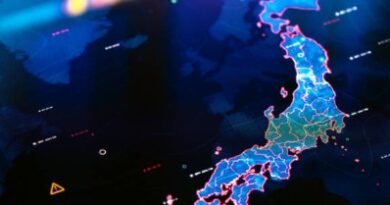
Satellite navigation systems such as GPS operate by receiving timing signals from multiple satellites orbiting Earth. Devices calculate their position based on the timing difference between those signals. Because the signals are relatively weak, they can be easily overwhelmed by stronger local transmissions designed to interfere with the navigation system.
Lisa Dyer explained that electronic warfare techniques used to manipulate or disrupt navigation signals have existed since the era of the World War II. Today, these technologies are widely used for both defensive and strategic military advantages.
However, experts warn that large-scale interference with navigation signals carries serious risks for civilian infrastructure. Aviation, commercial shipping, logistics networks, and emergency services all depend heavily on precise satellite navigation to operate safely.
The maritime sector in particular has been heavily affected by the interference. According to shipping analytics monitored by maritime intelligence firm Kpler, as many as 1,000 ships operating in the Gulf and the Gulf of Oman have experienced navigation disruption since the start of the conflict. Maritime analyst Dmitris Ampatzidis said this represents roughly half of all vessels currently operating in the region.
The majority of affected ships have been detected off the coasts of the UAE and Oman, where satellite navigation signals appear to be most heavily disrupted. Because many commercial vessels rely on older GPS technology that operates on a single navigation band, they are particularly vulnerable to signal interference compared to modern smartphones, which can access multiple satellite systems simultaneously.
Read :Cyberattacks Surge in Maritime Sector, Persistent Vessel Tracking Becomes Critical
In some cases, spoofing attacks have produced dramatic anomalies on ship-tracking platforms, making large oil tankers appear to be located on land inside the UAE or Iran rather than at sea. Similar disruptions have been reported in other regional conflicts, including interference affecting satellite signals as far away as Cyprus during the Gaza war.
Despite the inconvenience caused to daily navigation and commercial logistics, regional governments appear to view electronic warfare as a necessary defensive measure. The potential damage from a successful missile or drone strike on critical infrastructure such as ports, airports, or oil facilities far outweighs the disruption caused by temporary GPS interference.
As tensions continue to escalate across the Middle East, experts warn that satellite navigation disruptions could increase further, potentially affecting global shipping routes, energy transport, and aviation operations throughout the Gulf region ,one of the most strategically important corridors for international trade and oil transportation.